
WEATHER — National Weather Service officials predict that Moore County could see some severe weather from Hurricane Laura as she makes her way northeast. The hurricane made landfall Wednesday night as a category 4 storm near Cameron, Louisiana with recorded winds near 150 mph. It left over 500,000 without power in Louisiana and another 126,000 without power in Texas.
Highest risk Friday afternoon
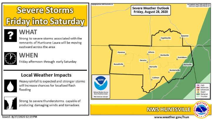
Locally, NWS officials in Huntsville predict the greatest threat of severe weather will come Friday afternoon. For this reason, many high school football games across southern, middle Tennessee – including the MCHS versus Community game – were moved up a day.
Friday afternoon and into Friday evening bands from Tropical Storm Laura will hit middle Tennessee with potential impacts ranging from heavy rainfall and flooding to downed trees with or without high winds due to saturated soil. The greatest threat will happen from 4-9 p.m. There’s also a smaller risk of severe thunderstorms and a few tornadoes. Expected rainfall will be around one to two inches.
Marginal risk continues onto to Saturday
The remnants of Tropical Storm Laura will continue toward the Ohio Valley on Saturday. Lingering heavy rain could fall in Lynchburg with gusty, damaging winds. According to NWS, a tornado or two cannot be ruled out, but the threat should diminish on Saturday. •
{The Lynchburg Times is the only independently owned and operated newspaper in Lynchburg. We cover Metro Moore County government, Jack Daniel’s Distillery, Nearest Green Distillery, Tims Ford State Park, Motlow State Community College, Moore County High School, Moore County Middle School, Lynchburg Elementary, Raider Sports, plus regional and state news.}